Add your own picture and explain the route, parking, gates, paths or landmarks that help people find it.
Earn 5 points after the picture is checked and accepted.
Add your photo and local directionsShare what you foundWhat is recorded here
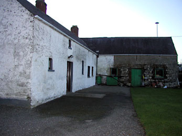
Semi-detached three-bay two-storey house, c. 1820. Rubble stone walls with lime render. Pitched natural slate roof with clay ridge tiles. Rendered chimneystack located centrally to roof. Small square-headed openings with replacement windows and sills. Rubble stone gate piers on round plan to immediate east. Connected to two outbuildings to create an L-shaped plan. Outbuilding to north has three bays. All openings to this outbuilding have brick surrounds. Loopholes to first floor indicate that this may originally have been an outbuilding.
This official record and map point do not grant access. Most recorded buildings are privately owned; view them only from public ground unless the owner allows entry.