Add your own picture and explain the route, parking, gates, paths or landmarks that help people find it.
Earn 5 points after the picture is checked and accepted.
Add your photo and local directionsShare what you foundWhat is recorded here
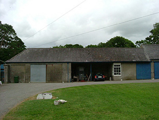
Attached single-storey farm building, constructed c. 1790. Rectangular-plan, attached to building to east. Hipped slate roof, clay ridge and hip tiles, timber sheeted projecting eaves to east end south elevation, profiled cast-iron gutters, ornamental hoppers, circular downpipes to south; corrugated-iron to north pitch. Unpainted smooth rendered ruled-and-lined walling to south, painted red brick and random stone rubble walling to west and north. Flat-arched central opening supported by steel beam and column with chamfered west reveal and painted timber sheeted ceiling. Square-headed corner window to west of central opening, painted timber twelve paned windows with top hung three pane casement to south. Square-headed door openings with painted timber vertically-sheeted and steel sliding doors. Cast-iron rain water tank supported on columns to west gable. Located to north of service yard with central grassed area and gravel paths, enclosed yard to east, house to south-east.
This official record and map point do not grant access. Most recorded buildings are privately owned; view them only from public ground unless the owner allows entry.