Add your own picture and explain the route, parking, gates, paths or landmarks that help people find it.
Earn 5 points after the picture is checked and accepted.
Add your photo and local directionsShare what you foundWhat is recorded here
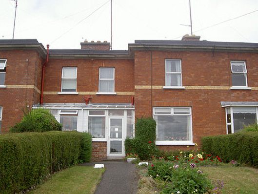
Terraced two-bay two-storey former coastguard house, dated 1943, built to replace similar structures burned c. 1920. Now in private domestic use. One of a terrace of six, L-plan, lean-to extension to north, porch to south. Flat roof, red brick chimneystack with sandstone capping, tooled sandstone corbelled eaves course. Red brick Flemish bond walling, yellow brick banding, machine-made brick to extension. Square-headed window openings, painted stone sills, uPVC casement windows,. uPVC windows and door to porch. Terrace set on north bank of Boyne estuary; bounded to front (south) with random coursed limestone wall, soldier coping, painted smooth rendered piers, wrought-iron gate; laneway to north giving access to rear sites.
This official record and map point do not grant access. Most recorded buildings are privately owned; view them only from public ground unless the owner allows entry.