Add your own picture and explain the route, parking, gates, paths or landmarks that help people find it.
Earn 5 points after the picture is checked and accepted.
Add your photo and local directionsShare what you foundWhat is recorded here
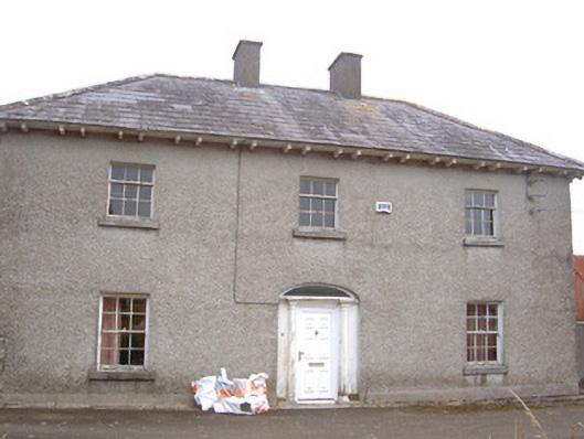
Detached three-bay two-storey house, built c. 1830. L-plan, returning three-bays to west, two-storey return at angle of "L" to north, lean-to and flat-roofed extensions added to north c. 1970. Hipped and pitched slate roofs, clay ridge and hip tiles, roughcast-rendered chimneystacks; projecting eaves, painted timber soffit, paired timber eaves brackets; cast-iron and uPVC rainwater goods. Roughcast-rendered walling, smooth rendered plinth. Square-headed window openings, tooled limestone sills, painted timber six-over-six sliding sash windows to ground floor, three-over-six to first floor, paired four-over four sliding sash to west elevation; some uPVC to extensions. Segmental-headed door opening, painted timber surround comprising engaged Tuscan columns supporting cornice, plain glazed uPVC-frame fanlight and uPVC door. House attached to single-storey stone outbuilding to north-west, forming west range of square-plan farmyard. Farmyard to north having four ranges of single and two-storey stone outbuildings surrounding cobblestone yard; pitched slate roofs, random rubble stone walling, square-headed window openings, diamond-pane lattice windows; square- and segmental-headed door openings, painted timber vertically-sheeted doors. House set back slightly from quiet country road to west, with farm land to north, south and east. Random rubble stone boundary wall to west, accessed through wrought-iron gates.
This official record and map point do not grant access. Most recorded buildings are privately owned; view them only from public ground unless the owner allows entry.