Add your own picture and explain the route, parking, gates, paths or landmarks that help people find it.
Earn 5 points after the picture is checked and accepted.
Add your photo and local directionsShare what you foundWhat is recorded here
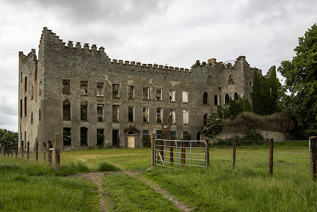
Detached multiple-bay three-storey Georgian house, built c. 1760, now in ruins. Shallow projecting curved bow to the east of south elevation c. 1805, tower house to west c.1350. House destroyed by fire in 2000. Roof not visible, hidden behind crenellated parapet, remains of red brick corbelled chimneystack to angle of fourteenth-century house and eighteenth-century house, south elevation. Roughcast-rendered over squared coursed rubble stone walling, coping to crenellations. Pointed arch square- and round-headed window openings, tooled limestone sills. Round-headed door opening to north elevation flanked by engaged tooled limestone columns, surmounted by broken pediment and fanlight, painted timber door with ten flat-panels, Plunkett family crest above pediment. House situated within field with ranges of random rubble stone outbuildings to west c. 1805, arranged around three yards; remains of walled garden to west, artificial lake to south, dovecot to south-west. Entrance gates to north-east on roadside comprising tooled limestone squared piers, cast-iron gates, flanked by pedestrian gates and curving quadrant plinth surmounted by cast-iron railings.
This official record and map point do not grant access. Most recorded buildings are privately owned; view them only from public ground unless the owner allows entry.