Add your own picture and explain the route, parking, gates, paths or landmarks that help people find it.
Earn 5 points after the picture is checked and accepted.
Add your photo and local directionsShare what you foundWhat is recorded here
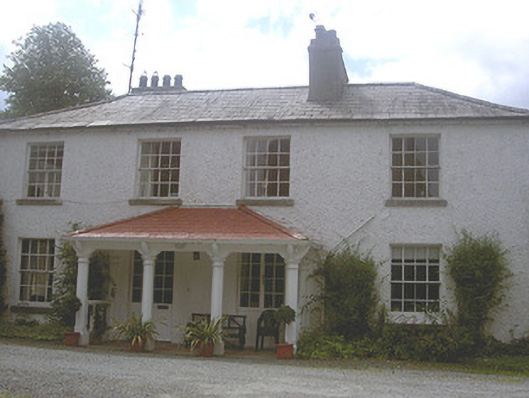
Detached four-bay two-storey former rectory, built c. 1770, now in private domestic use. L-plan, four-bays to east elevation, two-storey return to rear (south), entrance porch to north c. 1880. Hipped slate roof, clay ridge tiles, smooth rendered corbelled chimneystacks, cast-iron gutters, circular cast-iron downpipes. Painted roughcast-rendered walling. Square-headed window openings, painted smooth rendered reveals, tooled limestone sills, painted timber eight-over-eight timber sliding sash windows to north elevation, painted timber tripartite windows to east and west elevations. Open entrance porch, painted smooth rendered octagonal columns supporting hipped terracotta-tiled canopy roof with unglazed geometric tiled floor, paired square-headed door openings, painted timber and glazed double doors, west door now used as window. Enclosed yard to north-east, rubble masonry boundary walls, limestone ashlar gate piers, cobblestone paving, gravelled yard, ranges of single- and two-storey painted roughcast-rendered outbuildings, pitched and hipped slate roofs, square-headed door openings, segmental-headed carriage opening to west range; west range now in use as living accommodation. House set back from road in own landscaped grounds at end of private lane; entrance gateway to west, tooled limestone gate piers and wrought-iron gates.
This official record and map point do not grant access. Most recorded buildings are privately owned; view them only from public ground unless the owner allows entry.