Add your own picture and explain the route, parking, gates, paths or landmarks that help people find it.
Earn 5 points after the picture is checked and accepted.
Add your photo and local directionsShare what you foundWhat is recorded here
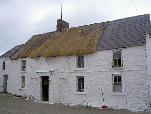
Detached three-bay two-storey straw thatched house, built c. 1775. Single-storey slate bay added to east and projecting square-headed porch added to south c. 1930. Two-storey outbuilding c. 1930, attached to west and single-storey outbuilding, c. 1930, to north-east. Range of two-storey outbuildings, c. 1850 to south-west. Pitched straw-thatched roof with brick chimneystack, thatch replaced by corrugated metal sheeting to rear (north). Lime-washed uncoursed rubble masonry walling. Square-headed window openings with rendered reveals, lime-washed stone sills and timber frame two-over-two sliding sash windows c. 1930. Square-headed door opening to projecting porch with tongue-and-groove timber door c. 1930. Three-bay two-storey range of outbuildings c. 1850 to south-west with pitched slate and corrugated metal roof, and having square-headed carriage openings to ground floor. House set back from road on private farm lane and surrounded by mature farmland.
This official record and map point do not grant access. Most recorded buildings are privately owned; view them only from public ground unless the owner allows entry.