Add your own picture and explain the route, parking, gates, paths or landmarks that help people find it.
Earn 5 points after the picture is checked and accepted.
Add your photo and local directionsShare what you foundWhat is recorded here
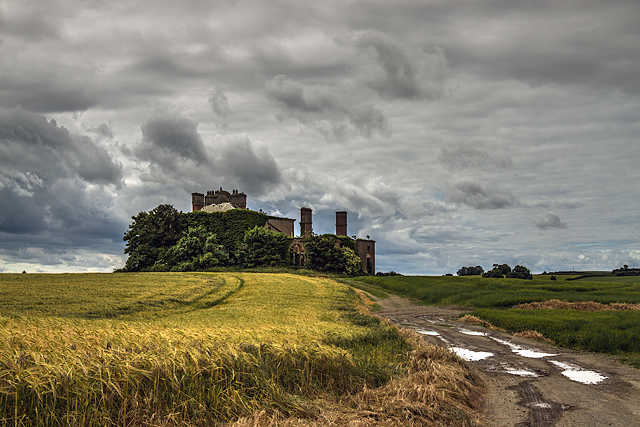
Detached five-bay two-storey over basement house, built c. 1790, now in ruinous condition, single-storey addition to south c. 1820, porch to entrance front, c. 1840. Hipped slate roof, partly missing, rendered chimneystacks to main house, red brick north wing. Cast-iron rainwater goods, partly missing. Unpainted cement-rendered walling, limestone trim, continuous eaves cornice, sill course, quoins. Square-headed window openings, rendered surrounds to first floor with flat entablatures, pedimented to ground floor, segmental-headed window openings at wing to north in moulded Gibbsian-style surround, all windows missing. Segmental-headed door opening in Gibbsian-style surround behind porch c. 1840, entablature supported on Tuscan columns. Located on top of elevated position overlooking surrounding countryside, now surrounded by fields. Range of farm buildings to south-east including concrete water tower, single-storey rubble stone farm buildings corrugated fibre-concrete sheeted roofs, red brick surrounds to loop windows. Tower keep in curtilage of south-west, now surrounded by fields.
This official record and map point do not grant access. Most recorded buildings are privately owned; view them only from public ground unless the owner allows entry.