Add your own picture and explain the route, parking, gates, paths or landmarks that help people find it.
Earn 5 points after the picture is checked and accepted.
Add your photo and local directionsShare what you foundWhat is recorded here
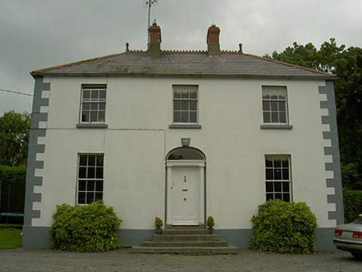
Detached three-bay two-storey house, dated 1857. Built on T-plan with two-storey return to rear. Hipped slate roof, crested ridge tiles, terracotta finials, red brick chimneystacks, moulded cast-iron gutters and downpipes. Painted ruled-and-lined smooth rendered walling, raised quoins, chamfered plinth course. Square-headed window openings, painted reveals, sills, containing three-over-six to first floor, six-over-six to ground floor, timber sliding sash windows. Segmental-headed door opening, painted reveal, painted moulded rendered keystone reading "1857", plain glazed fanlight above timber entablature supported on engaged door columns flanking timber panelled door, accessed via four limestone steps. Opening onto gravelled drive, gardens, long avenue leads to main road. Built close to the river near site of mill, demolished c 1970s. Lean-to shed at garden wall, stone farm buildings to north. Situated near weir on River Fane.
This official record and map point do not grant access. Most recorded buildings are privately owned; view them only from public ground unless the owner allows entry.