Add your own picture and explain the route, parking, gates, paths or landmarks that help people find it.
Earn 5 points after the picture is checked and accepted.
Add your photo and local directionsShare what you foundWhat is recorded here
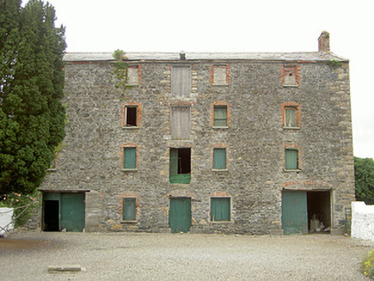
Detached five-bay four-storey former granary, built c. 1810. Rectangular-plan, gable-fronted extension to east, ramp to north gable third-storey with squared coursed rubble plinth walling, rendered segmental coping. Pitched slate roof, clay ridge tiles, stone verge coping, red brick bellcotes to gables, remains of winch to west elevation, red brick corbel eaves course. Coursed rubble walling, roughly squared sandstone quoins. Square-headed window openings, red brick block-and-start surrounds, relieving arches, timber lintels, stone sills, some timber sheeted shutters in-situ. Square-headed door openings, red brick block-and-start surround, painted timber sheeted door to north, square-headed door and loading bays to west, timber lintels, redbrick relieving arches, painted timber sheeted doors. Set back from main road within grounds of ruined mill complex now used as pasture land.
This official record and map point do not grant access. Most recorded buildings are privately owned; view them only from public ground unless the owner allows entry.