Add your own picture and explain the route, parking, gates, paths or landmarks that help people find it.
Earn 5 points after the picture is checked and accepted.
Add your photo and local directionsShare what you foundWhat is recorded here
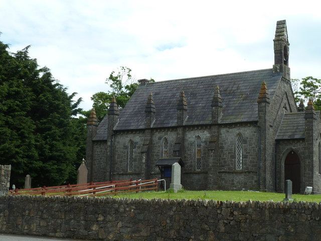
Freestanding Church of Ireland church, built c. 1845. Rectangular-plan with four-bay nave, dressed stone pitched stepped bellcote to west gable, gable-fronted chancel projecting to east, gable-fronted porch to west; gable-fronted porch to south. Pitched slate roofs, clay ridge tiles, unpainted stone flat-capped chimneystack to east gable, square stone corbelled eaves, moulded uPVC gutters. Unpainted squared-and-snecked rubble walling, chamfered stone plinth, chamfered limestone continuous sill course; string course to east and west gables following profile of roofs, square stepped buttresses to nave, clasping buttresses to corners, pyramidal stepped capped pinnacles, unpainted smooth rendered walling to porch, projecting plinth and quoins. Lancet window openings, dressed limestone chamfered reveals and sills, painted leaded diamond-pattern quarry glass panes, decorative circular vents to south porch windows, tripartite lancet windows to east, trefoil window opening chamfered surround to west. Pointed arch door openings, dressed limestone chamfered door surround, varnished timber vertically-sheeted door to south porch, limestone plinth stones, leading step. Set within graveyard, elevated site, random rubble boundary wall, soldier coping, random rubble dressed stone gate archway to north, soldier coping, mild steel gate, former school to south-west.
This official record and map point do not grant access. Most recorded buildings are privately owned; view them only from public ground unless the owner allows entry.