Add your own picture and explain the route, parking, gates, paths or landmarks that help people find it.
Earn 5 points after the picture is checked and accepted.
Add your photo and local directionsShare what you foundWhat is recorded here
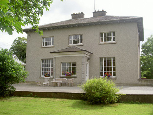
Detached three-bay two-storey over basement former rectory, built c. 1840, now in use as private house. Rectangular-plan, single-storey porch added to west. Hipped slate roof, lead hips and ridges, rendered chimneystacks, flat cap stones, overhanging painted-timber lined eaves, scrolled brackets, cast-iron gutters. Painted roughcast rendered walling, smooth rendered slightly projecting chamfered plinth, rendered quoins to porch. Square-headed window openings, slightly projecting smooth rendered soffits and reveals, painted timber tripartite windows to east and west elevations; painted timber six-over-six and three-over-three sliding sash windows to south elevation; wrought-iron bars to basement windows north elevation, round-headed window opening, painted timber paired casement windows with margins and spoked fanlight. Square-headed door opening to south elevation of porch, painted timber moulded surround, painted timber and glazed panelled door, tooled limestone step. Outbuildings to north converted to living accommodation; single-storey north range, random rubble coursed walling, red brick dressings, segmental-headed carriage arches infilled; east range converted to two-storey house. Set in mature garden with curving avenue to road, random coursed rubble boundary wall, granite gate piers and wrought-iron gates.
This official record and map point do not grant access. Most recorded buildings are privately owned; view them only from public ground unless the owner allows entry.