Add your own picture and explain the route, parking, gates, paths or landmarks that help people find it.
Earn 5 points after the picture is checked and accepted.
Add your photo and local directionsShare what you foundWhat is recorded here
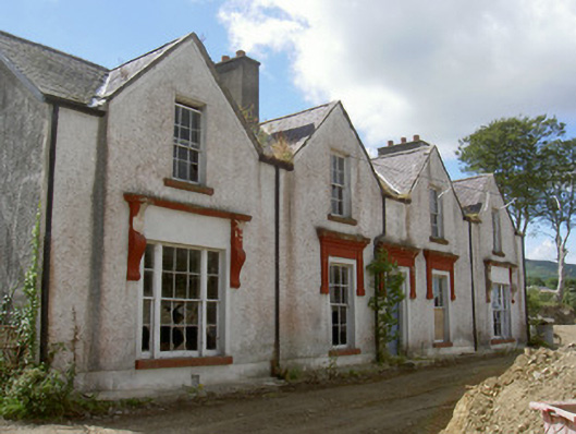
Detached four-bay two-storey house, built c. 1740, no longer in use. Formerly T-plan, gabled bays to east, gabled east bay to south elevation, return and flat-roofed extension to west. Pitched slate roofs, clay ridge tiles, stone verge coping and raking cornices to pediments, lead valleys, unpainted smooth rendered chimneystacks, moulded cast-iron gutters on smooth rendered eaves course. Painted roughcast rendered walling, smooth rendered plinth. Square-headed window openings, painted smooth rendered soffits and reveals, smooth rendered surrounds with cornices supported on pilasters to ground floor east elevation, painted stone sills, painted timber six-over-six sliding sash windows, tripartite to north and south bays ground floor east elevation and pedimented bay south elevation with six-over-six flanked by two-over-two panes, tripartite to west elevation with four-over-four flanked by two-over-two panes; timber casement windows to south. Square-headed door opening to east, smooth rendered surround flanked by short pilasters supporting frieze and cornice, painted timber four-panel door, timber diamond-pane overlight, limestone step. Set on elevated site with view of Carlingford Lough to east, now surrounded by building site.
This official record and map point do not grant access. Most recorded buildings are privately owned; view them only from public ground unless the owner allows entry.