Add your own picture and explain the route, parking, gates, paths or landmarks that help people find it.
Earn 5 points after the picture is checked and accepted.
Add your photo and local directionsShare what you foundWhat is recorded here
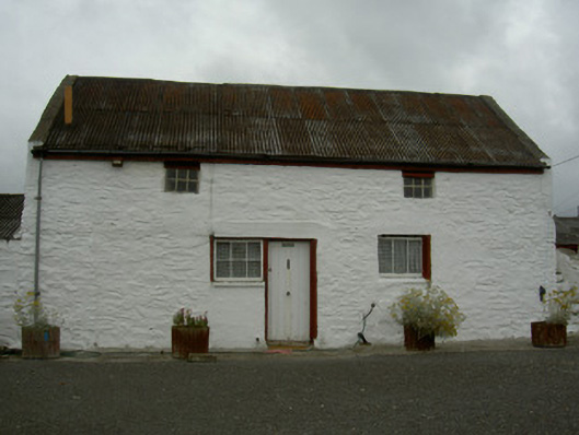
Range of farm buildings, built c. 1810. Rectangular-plan on east-west axis, two-bay two-storey main building with external steps to east gable, single-storey extension to west, lean-to to west of extension, two single-storey outbuildings to west and south-east of main building, small outbuilding to east. Pitched corrugated-iron roof to main building, extensions and outbuildings, concrete verges to gables, uPVC gutters on painted timber fascias on eaves corbel course to main house and south-east outbuilding; pitched corrugated-iron roof held down by stone blocks to west extension; single-pitched slate roof to east outbuilding. Painted smooth rendered walling to west outbuilding, whitewashed rubble stone walling, painted brick quoins to remaining buildings. Square-headed window openings to main building, painted stone sills, painted timber lintels, painted timber casement windows. Square-headed door opening to centre of south elevation of main building, painted timber vertically-sheeted door, cast-iron door knocker. Complex set back from road, large garden, painted rubble stone boundary wall.
This official record and map point do not grant access. Most recorded buildings are privately owned; view them only from public ground unless the owner allows entry.