Add your own picture and explain the route, parking, gates, paths or landmarks that help people find it.
Earn 5 points after the picture is checked and accepted.
Add your photo and local directionsShare what you foundWhat is recorded here
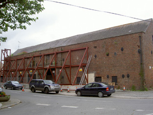
Corner-sited detached multiple-bay two-storey former mill, dated 1866, now disused. L-plan, extended to south, return wing to rear (east). Pitched slate roofs, clay ridge tiles, set behind parapet to front (west), cast-iron downpipes. Flemish bond red brick walling, dressed stone parapet coping, wrought-iron ties with cast-iron pattress plates, date stone. Square-headed window openings, blocked to front, tooled limestone sills, remains of timber windows to east. Blocked square-headed door opening, cut limestone surround comprising pilasters, console brackets and cornice; square-headed door opening at site of weigh bridge, painted timber vertically-sheeted doors. Segmental-headed carriage arch, brick arch, painted timber vertically-sheeted double gates incorporation wicket gate. Fronted onto village green.
This official record and map point do not grant access. Most recorded buildings are privately owned; view them only from public ground unless the owner allows entry.