Add your own picture and explain the route, parking, gates, paths or landmarks that help people find it.
Earn 5 points after the picture is checked and accepted.
Add your photo and local directionsShare what you foundWhat is recorded here
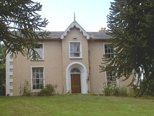
Detached three-bay two-storey house, built c. 1850. T-plan, projecting gable-fronted breakfront to east, return and lean-to extension to north-west; lean-to extension to south-west. Pitched slate roof, clay ridge tiles, roughcast-rendered chimneystacks with stone caps and clay pots, uPVC gutters supported on timber eaves course, uPVC downpipes, some circular cast-iron downpipes; painted timber decorative bargeboards to projecting gabled breakfront. Painted roughcast-rendered walling, painted smooth rendered plinth, block-and-start quoins, painted smooth rendered ruled-and-lined return and extension. Square-headed window openings, painted smooth rendered surround, painted stone sills, painted timber six-over-six sliding sash windows to ground floor, three-over-six sliding sash windows to first floor some uPVC windows to south elevation of return. Round-headed recessed door opening, painted smooth rendered surround, deeply splayed reveals and soffit, timber door with four raised-and-fielded panels, surmounted by simple spoked fanlight, door accessed by limestone steps. Circular brick well to north-west of house, cast-iron water pump to north-west elevation. Cast-iron pedestrian gate in north boundary wall flanked by painted tooled stone square-profile piers surmounted by pyramidal caps. House situated in own grounds bounded by random rubble stone wall, accessed through square-profile random rubble piers with cast-iron gates to east.
This official record and map point do not grant access. Most recorded buildings are privately owned; view them only from public ground unless the owner allows entry.