Add your own picture and explain the route, parking, gates, paths or landmarks that help people find it.
Earn 5 points after the picture is checked and accepted.
Add your photo and local directionsShare what you foundWhat is recorded here
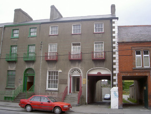
End-of-terrace three-bay three-storey over basement former town house, built 1851, now in commercial use. Central entrance, two-storey return to north, integral carriage arch to east. Pitched artificial slate roof, clay ridge tiles, unpainted smooth rendered corbelled chimneystacks, moulded cast-iron gutters on eaves corbel course, cast-iron downpipes. Unpainted smooth rendered ruled-and-lined walling, painted stone V-jointed quoins to east. Square-headed window openings, painted stone sills, painted smooth rendered slightly-projecting reveals and soffits, cast-iron balconnettes to first floor, painted timber eight-over-eight sliding sash window to ground floor, six-over-six to first floor, three-over-three to second floor, painted timber casement to basement. Round-headed entrance door opening, painted smooth rendered bull-nosed reveal, moulded entablature on engaged Doric columns flanking painted timber door with six bolection-moulded panels, petal fanlight, concrete approach steps, cast- and wrought-iron balustrades; elliptical-headed carriage arch, painted smooth rendered bull-nosed reveal, blind painted timber sunburst overpanel, decorative moulded frieze, painted timber vertically-sheeted gates incorporating wicket. Set back from street behind basement area; cast- and wrought-iron railings, stone plinth; carpark to north, small yard bounded by random rubble stone walls; lower and later two-storey brick building projecting to east.
This official record and map point do not grant access. Most recorded buildings are privately owned; view them only from public ground unless the owner allows entry.