Add your own picture and explain the route, parking, gates, paths or landmarks that help people find it.
Earn 5 points after the picture is checked and accepted.
Add your photo and local directionsShare what you foundWhat is recorded here
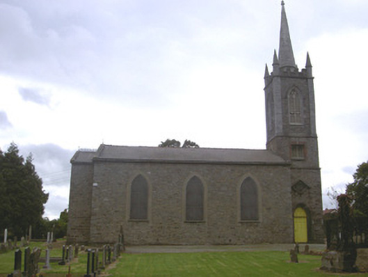
Freestanding Church of Ireland church, dated 1807, three-bay nave, projecting gable-fronted chancel to east, square-plan three-stage bell tower to west, single-storey limestone ashlar vestry added to south-east dated 1909. Pitched slate roof, brick chimneystack, cast-iron ridge comb to chancel, moulded cast-iron gutters, circular cast-iron downpipes, tooled limestone verge coping to gables. Uncoursed random rubble stone walling, tooled limestone quoins, limestone ashlar pediment surrounds to gables; ashlar limestone string courses, dressing, pinnacles and steeple to tower; carved limestone date plaques to tower and to vestry. Pointed arch window openings, flat smooth render surrounds, limestone tracery, limestone sills, stained-glass leaded lights, fine mesh protective metal screens; carved limestone hood-moulding to tower window, west; square-headed window openings to second-stage tower, block-and-start brick surrounds, limestone sills, louvred timber shutters. Pointed arch door opening to north elevation of tower, ashlar limestone chamfered surround, painted timber panelled door c. 1909, painted timber fanlight; limestone flag stone to entrance. Set back from road in own burial grounds, variety of cut stone grave markers c. 1800-2000, ruined abbey c. 1400-1500 to south, rubble masonry boundary walls with ashlar coping, rock-faced square-profile gate piers, cast-iron gates.
This official record and map point do not grant access. Most recorded buildings are privately owned; view them only from public ground unless the owner allows entry.