Add your own picture and explain the route, parking, gates, paths or landmarks that help people find it.
Earn 5 points after the picture is checked and accepted.
Add your photo and local directionsShare what you foundWhat is recorded here
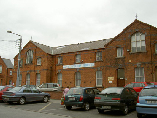
Detached nine-bay two-storey former school, built c. 1900, now in use as community centre. Recessed central three-bay section flanked by gable-fronted three-bay blocks having breakfront central bays to east and west. Pitched slate roofs, clay ridge tiles, gable-fronted ventilators with trefoil motif to roof ridge, decorative ironwork finials to gable ends, cast-iron gutters on bracketed eaves, circular cast-iron downpipes. Red brick walling laid in Flemish bond, polychromatic brick courses to sill and lintel levels, chamfered plinth, stepped brick eaves course to east and west gables of south elevation. Segmental- and square-headed window openings, four-centred-arched openings to advanced bays of east and west gables of south elevation, vitrified brick enrichments to window heads, trefoil motif to limestone keystones, tooled limestone sills, recessed stepped brick panels flank openings, painted timber two-over-two sliding sash windows; painted timber traceried fixed pane windows to advanced gable section. Segmental-headed door openings, vitrified brick enrichments to arches, trefoil motif to limestone keystones, large plain-glazed overlights, painted timber and glazed double doors to west elevation; timber panelled door to east gable. Set in bitumen surfaced area now in use as carpark, located on Fair Street in close proximity to other former schools, convents and orphanage.
This official record and map point do not grant access. Most recorded buildings are privately owned; view them only from public ground unless the owner allows entry.