Add your own picture and explain the route, parking, gates, paths or landmarks that help people find it.
Earn 5 points after the picture is checked and accepted.
Add your photo and local directionsShare what you foundWhat is recorded here
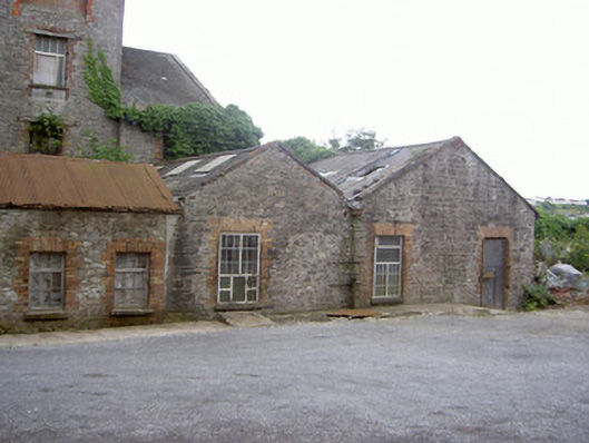
Attached five-bay single-storey store house, built c. 1820, no longer in use. Rectangular-plan, two-bay extension c. 1850 to east, abutting larger structure to south, paired gabled bays to west of north elevation. Pitched slate roofs, stone verge coping to gabled bays, corrugated-iron pitched roof to east extension, exposed original rafters to eaves of west elevation, cast-iron hopper and section of downpipe to north elevation. Random rubble stone walling, tooled stone quoins to gabled bays, roughcast-rendered walling to west elevation. Square-headed window openings, red brick block-and-start surrounds, tooled limestone and concrete sills, replacement timber and uPVC casements. Square-headed door opening, red brick block-and-start surround, sheet-metal security door. Earthen ramp to roof-line of south and west elevations, gravel to north, rubbish dump to west.
This official record and map point do not grant access. Most recorded buildings are privately owned; view them only from public ground unless the owner allows entry.