Add your own picture and explain the route, parking, gates, paths or landmarks that help people find it.
Earn 5 points after the picture is checked and accepted.
Add your photo and local directionsShare what you foundWhat is recorded here
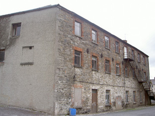
Attached seven-bay three-storey store house, built c. 1820, no longer in use. Irregular plan, single-storey flat-roofed extension to east. Hipped slate roof, clay ridge tiles, some cast-iron gutters on corbelled eaves course, circular cast-iron downpipe to south elevation. Roughly squared random stone walling to south elevation, tooled ashlar limestone block-and-start quoins, cast-iron tie brackets to north and south elevations, roughcast-rendered walling to north, east and west elevations; mild-steel fire escape to south elevation. Square-headed window openings, brick block-and-start surrounds, tooled limestone sills, timber casement and uPVC windows. Square-headed door openings to south elevation, painted brick surround, timber vertically-sheeted double doors, plain-glazed overlight, square-headed door opening to north, painted timber vertically-sheeted double doors; centrally located goods opening to south elevation now blocked-up. Directly abutting houses to north, gravelled yard to south.
This official record and map point do not grant access. Most recorded buildings are privately owned; view them only from public ground unless the owner allows entry.