Add your own picture and explain the route, parking, gates, paths or landmarks that help people find it.
Earn 5 points after the picture is checked and accepted.
Add your photo and local directionsShare what you foundWhat is recorded here
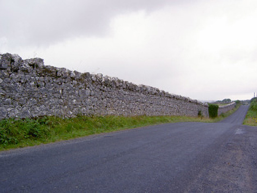
Former deer park on irregular oval shaped-plan associated with Newcastle House (13402709), built/laid-out c. 1800, surrounded by high rubble limestone boundary wall having rubble stone coping over. Complex of outbuildings located to the east side of the deer park comprising a detached two-bay two-storey outbuilding, built c. 1870, having exterior flight of steps to east elevation to south of yard and a detached two-bay single-storey outbuilding with attic storey to the east side of yard. Buildings now out of use, deerpark now in use as farmland. Single-storey open shed attached to the west gable of two-storey outbuilding. Pitched natural slate roof to two-storey building having remains of brick chimneystack offset to the west side of centre; pitched corrugated-metal roof to single-storey outbuilding having raised rendered verges to gable ends. Random rubble limestone walls with roughly dressed flush limestone quoins to the corners. Square-headed window and door openings, the latter having timber battened doors. Brick voussoirs to openings to south outbuilding; two-square-headed openings to outbuilding to the east having sliding battened timber doors. Modern walls to site. Located to the southwest of former gate lodge/gamekeeper’s house (13402724), and to the southwest of Newcastle House. Sited to the south of Ballymahon, close to border with County Westmeath to the south.
This official record and map point do not grant access. Most recorded buildings are privately owned; view them only from public ground unless the owner allows entry.