Add your own picture and explain the route, parking, gates, paths or landmarks that help people find it.
Earn 5 points after the picture is checked and accepted.
Add your photo and local directionsShare what you foundWhat is recorded here
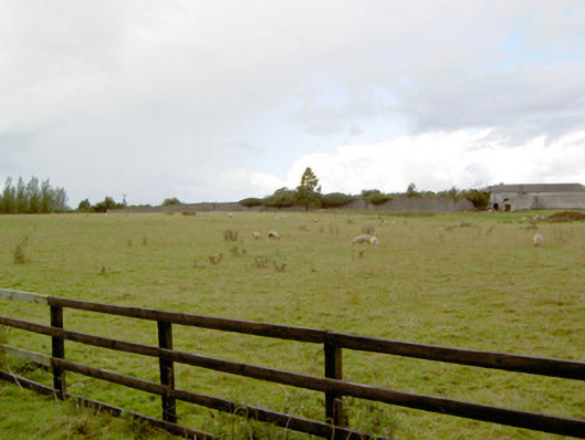
Walled garden(s) on rectangular-plan associated with Newcastle House (13402709), built c. 1780. Now in use as pasture/farmland. Random rubble boundary walls; brick lined to internal faces to a number of walls. Cut stone coping over a number of the walls; walls collapsed in places. Garden subdivided to the northwest end by red brick wall. Two multiple-bay single-storey outbuildings to the northwest side of dividing wall (one to northeast and one to southwest), built c. 1820, having lean-to natural slate roofs, brick walls and square-headed openings with remains of timber sash windows and timber battened doors. Round-headed openings in to outbuilding to the southwest. Single-storey glass/green houses to the southeast face of dividing wall (corresponding with locations of above outbuildings), built c. 1820, having pitched glass and timber roofs and having window openings over plinth walls. Roof ventilation openings along roof apex. Majority of glass now broken and replaced with corrugated-metal sheeting. Additional freestanding glass/green house to southwest, built c. 1880, now ruinous. Square-headed door opening to southeast boundary wall having tooled cut limestone block-and-start surround, opening now blocked. Located to the west/southwest of Newcastle House (13402709), and to the east of Ballymahon.
This official record and map point do not grant access. Most recorded buildings are privately owned; view them only from public ground unless the owner allows entry.