Add your own picture and explain the route, parking, gates, paths or landmarks that help people find it.
Earn 5 points after the picture is checked and accepted.
Add your photo and local directionsShare what you foundWhat is recorded here
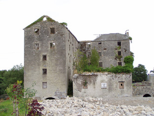
Detached multiple-bay five-storey former corn and flour mill, and stores, on L-shaped plan with, built c. 1800 and extended c. 1850, having attached four-storey former corn kiln to the north elevation and detached three-bay single-storey former office building to the south. Now ruinous and out of use; internal floors now collapsed. Remains of hipped and pitched natural slate roofs with cut stone eaves course. Roughcast rendered walls over coursed rubble stone and rubble stone construction. Flush dressed limestone block-and-start quoins to the corners of the five-storey block to the south (south end). Cast-iron wall ties/pattrice plates to walls. Square-headed openings some with remains of some six-over-three pane timber sliding sash windows; majority of windows and frames now removed. Square-headed doorways to east elevation. Brick surrounds and voussoirs evident to a number of window and door openings. Round-headed arched openings to former millraces to the south gable end of block to south, to the north elevation, and to the east side of former office building to southeast having dressed limestone voussoirs. Round-headed opening to gable apex of range to south. Remains of former breast-shot millwheel to the west end of block to north having cast-iron axle and rings with timber spokes and remains of timber floats. Set back from road in own grounds on the east bank of the River Inny with remains of weir to the north. Brick vaulting and former ovens to former drying kiln to the north elevation. Single-storey former outbuilding to the northeast. Ruinous three-storey former corn mill located across the Inny to the west having rubble stone walls and square-headed openings.
This official record and map point do not grant access. Most recorded buildings are privately owned; view them only from public ground unless the owner allows entry.