Add your own picture and explain the route, parking, gates, paths or landmarks that help people find it.
Earn 5 points after the picture is checked and accepted.
Add your photo and local directionsShare what you foundWhat is recorded here
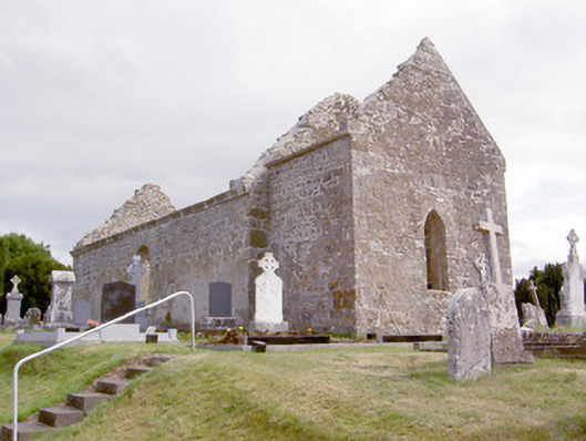
Freestanding three-bay church, built c. 1680 and altered c. 1750, with single-bay addition/porch or first stage of former tower to the west gable end. Now in a state of ruin with roof now gone. Rubble stone masonry walls, recently repointed, with cut limestone eaves cornice. Remaining sections of roughcast lime render to walls. Round-headed window openings with roughly dressed voussoirs over. Square-headed door opening to south side of addition/tower to the west with cut limestone block-and-start surround having architrave and Gibbsian-type keystone over. Remains of carved wall plaques and memorials to interior of church. Set in graveyard on roughly rectangular-plan having rubble stone boundary walls. Rebuilt gateway to the east side of graveyard comprising a section of rock-faced limestone walling having integral round-headed chamfered cut limestone surround and wrought-iron flat-bar. Recessed square-headed panels to either side of entrance having Latin inscriptions (dated 1649) in bas relief. Collection of upstanding, recumbent and table-type cut stone grave markers to site, mainly dating from the eighteenth century to the twentieth century, some with cast- and/or wrought-iron railed surround. Located in the rural countryside to the south of Keenagh.
This official record and map point do not grant access. Most recorded buildings are privately owned; view them only from public ground unless the owner allows entry.