Add your own picture and explain the route, parking, gates, paths or landmarks that help people find it.
Earn 5 points after the picture is checked and accepted.
Add your photo and local directionsShare what you foundWhat is recorded here
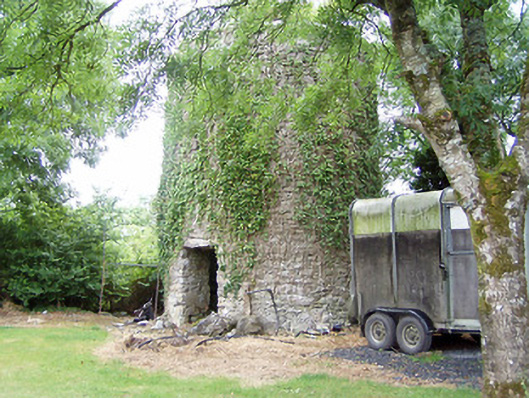
Remains of two-storey windmill (corn) on circular-plan, built c. 1770. Constructed with coursed rubble limestone with remains of lime render over. Remains of cut stone coping over. Remains of two doorways, one to the southeast face and one to the northwest face, having narrow slit window openings/loop hole openings over. Roughly cut limestone lintels over doorways. Remains of staircase to interior, curving around wall from the northwest doorcase. Located in grounds of modern house to the south of Lanesborough. Sited on top of a hill in an elevated position to the east of Lough Ree. Possible remains of earlier windmill (on circular-plan) adjacent to the northeast.
This official record and map point do not grant access. Most recorded buildings are privately owned; view them only from public ground unless the owner allows entry.