Add your own picture and explain the route, parking, gates, paths or landmarks that help people find it.
Earn 5 points after the picture is checked and accepted.
Add your photo and local directionsShare what you foundWhat is recorded here
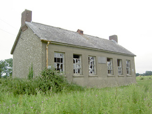
Detached six-bay single-storey former national school, built c. 1937, having gable-fronted two-bay single-storey projection to rear (north) having entrances to side elevations. Now disused. Pitched natural slate roofs with metal roof vent and cast-iron rainwater goods. Slightly projecting red brick chimneystacks to gable ends (east and west) partially supported on brick cobbled course. Smooth rendered walls with carved limestone name and date plaque to front façade (south). Square-headed window openings with remains of six-over-six pane timber sliding sash windows and rendered sills. Four-over-four pane timber sliding sash windows to north face of rear porch projection. Square-headed door openings to side elevations of rear porch having timber battened doors. Set back from road in own grounds to the northwest of Ardagh. Rubble and coursed limestone boundary wall with cement coping over to road-frontage (south) and rubble stone wall to the rear (north) dividing enclosed area into two separate yards. Main entrance gateway to the south comprising a pair of coursed limestone gate piers (on square-plan) having cut stone coping over and a pair of wrought-iron flat bar gates. Low rubble stone boundary walls to the west wend of boundary wall to road frontage having wrought-iron railings over. Cast-iron post box (13401903) built into boundary wall.
This official record and map point do not grant access. Most recorded buildings are privately owned; view them only from public ground unless the owner allows entry.