Add your own picture and explain the route, parking, gates, paths or landmarks that help people find it.
Earn 5 points after the picture is checked and accepted.
Add your photo and local directionsShare what you foundWhat is recorded here
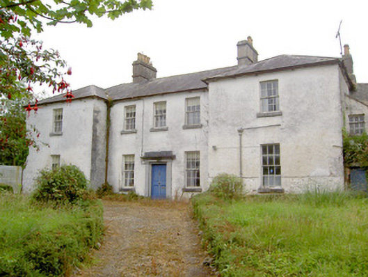
Detached five-bay two-storey former Church of Ireland rectory, built c. 1760 (and possibly remodelled c. 1830), having advanced single-bay projections to either end of the front elevation (north) and canted projections to either end of the rear elevation (south). Single-storey block with attic storey (including half-gable) to the west end, aligned along with house, having single-bay outbuilding attached to the west end and a single-storey lean-to outbuilding attached to the north. Now disused. Hipped natural slate roofs with lead ridge capping, projecting eaves course, a pair of central rendered chimneystacks with terracotta chimney pots and cast-iron rainwater goods. Pitched slate roof to block to the west having pronounced projecting eaves course, small slates and rendered rubble stone chimneystack to the west gable end. Painted roughcast rendered walls, render removed to plinth section of advanced bays exposing random rubble stone construction. Flush cut stone quoins evident to the corners of projection to the east end of main elevation (north). Square-headed diminishing window openings having six-over-six pane timber sliding sash windows and tooled cut limestone sills. Square-headed window openings to block to west having three-over-three pane timber sash window to gablet and multipane timber sash windows elsewhere. Square-headed door opening to the centre of the front elevation with timber panelled door and having cut limestone surround comprising pilasters (on square-plan) having moulded detailing to bases supporting lintel over having moulded cornice. Timber window shutters extant to interior. Set back from road in extensive mature, now overgrown, grounds. Main entrance gates to the east comprising a pair if dressed ashlar limestone gate piers (on square-plan) having capstones and cut stone wheel guards. Located to the west of Ardagh and to the north of associated Church of Ireland church (13401902), now out of use.
This official record and map point do not grant access. Most recorded buildings are privately owned; view them only from public ground unless the owner allows entry.