Add your own picture and explain the route, parking, gates, paths or landmarks that help people find it.
Earn 5 points after the picture is checked and accepted.
Add your photo and local directionsShare what you foundWhat is recorded here
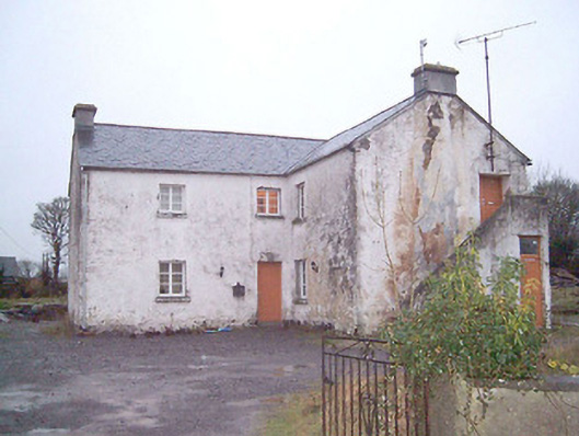
Detached three-bay two-storey national school on T-plan, built c. 1836, having two-storey projection to the centre of the southeast elevation. Later in use as dance hall, sports hall and technical school. Possibly also originally in use as a school master's residence. Now in use as a private dwelling. External staircase with rendered parapet wall to the northeast gable end giving access to square-headed doorway at first floor level. Pitched natural slate roofs with cut stone eaves course and having rendered chimneystacks to gable ends. Roughcast lime rendered walls over squared rubble stone construction. Square-headed window openings with cut stone sills and timber casement windows. Square-headed door openings with timber battened doors. Set back from road in own grounds to the southeast of Lanesboro adjacent to road junction. Rendered boundary to road-frontage. Modern gateway to the northeast.
This official record and map point do not grant access. Most recorded buildings are privately owned; view them only from public ground unless the owner allows entry.