Add your own picture and explain the route, parking, gates, paths or landmarks that help people find it.
Earn 5 points after the picture is checked and accepted.
Add your photo and local directionsShare what you foundWhat is recorded here
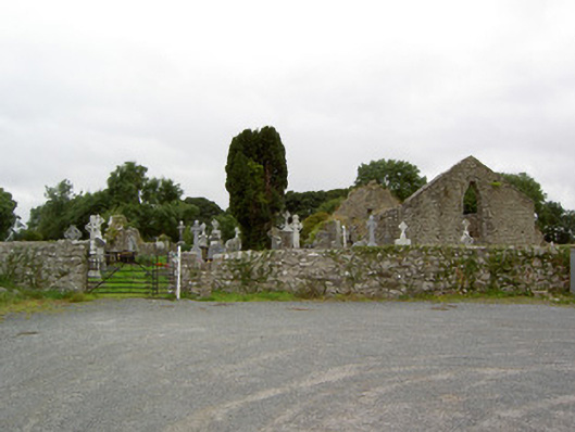
Graveyard on sub rectangular-plan, built c. 1650, and containing a collection of grave markers, both upstanding and recumbent, of mainly eighteenth and nineteenth century date. Number of late-seventeenth century grave markers to site. Still in use. Detached single-cell Church of Ireland church, built c. 1650, incorporating fabric of earlier building to site. Now a roofless ruin. Roughly coursed squared limestone and rubble limestone construction with roughly dressed flush limestone quoins to the corners. Base batter to east gable end, and rubble stone buttress to the east end of the north elevation. Pointed arch window opening to west gable end, ogee-headed window opening with tooled limestone surround to west gable end having carved sheela-na-gig or an exhibitionist figure (LF017-013002-) in bas relief to the north jamb. Arched doorway (possibly originally Tudor-arched, now partially collapsed) to the east end of the south elevation. Site surrounded by rubble stone boundary walls. Entrance to the southeast comprising a wrought-iron flat bar gate and wrought-iron pedestrian turnstile gate. Cut stone stile to the north of gateway. Set well back from road to the south of Lanesborough, close to the remains of Rathcline Castle (LF017-019---) to the north, and close to the shores of Lough Ree to the west.
This official record and map point do not grant access. Most recorded buildings are privately owned; view them only from public ground unless the owner allows entry.