Add your own picture and explain the route, parking, gates, paths or landmarks that help people find it.
Earn 5 points after the picture is checked and accepted.
Add your photo and local directionsShare what you foundWhat is recorded here
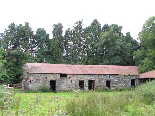
Complex of single- and two-storey outbuildings associated with Moorhill House (13401508), built c. 1815 and c. 1880, comprising two yards of outbuildings and a walled garden. Complex to the northwest comprises a multiple-bay two-storey outbuilding to the southwest side with pitched corrugated-metal roof, coursed and squared rubble limestone walls, square-headed openings with timber fittings to ground floor and loop hole openings to first floor; multiple-bay single-storey hayshed, c. 1880, to northwest with corrugated-metal barrel roof, rubble limestone gable walls and cast-iron columns to open southeast elevation; and a single-storey outbuilding to the southeast (built c. 1815 and extended c. 1880) with lean-to corrugated-metal and slate roof, rubble limestone walls and square-headed openings. Wrought-iron farm gates and rubble limestone walls to south and north corners of yard. Complex to the southeast (adjacent to house) comprising multiple-bay two-storey building to northeast (c. 1815), having pitched slate roof, rendered rubble stone walls, square-headed window openings with stone sills, square-headed door openings with some remaining timber battened half doors, elliptical-headed carriage arch with replacement door, and with loop hole openings to upper storey; multiple-bay two-storey outbuilding to the southwest (abutting rear return of house), built c. 1815, having pitched natural slate roof, cut stone bellcote to northwest gable end, painted rendered walls, chamfered to one corner, square-headed openings with timber fittings, loop hole windows to upper storey, and elliptical-headed carriage arch with corrugated-steel doors; single-bay single-storey outbuilding to northeast, c. 1880, with hipped slate roof, and painted rendered walls with tie bars. Wrought-iron farm gate to west side of gable of southwest range, cut stone pier )on square-plan) to south of west gable of northwest range. Former walled garden on rectangular-plan to northeast of yards having rubble stone boundary walls with replacement gate to southwest wall from southeast yard. Situated to the rear of Moorhill House (northwest), and to the south of Granard.
This official record and map point do not grant access. Most recorded buildings are privately owned; view them only from public ground unless the owner allows entry.