Add your own picture and explain the route, parking, gates, paths or landmarks that help people find it.
Earn 5 points after the picture is checked and accepted.
Add your photo and local directionsShare what you foundWhat is recorded here
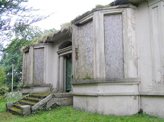
Detached three-bay single-storey over basement house, built c. 1880, having canted bay windows to front elevation, flanking central doorcase, and four-bay side elevations (northwest and southeast). Now disused. Shallow hipped natural slate roof with rendered chimneystacks and cast-iron rainwater goods. Painted rendered walls with render strip quoins to corners. Projecting string course to side elevations, separating ground floor and basement levels. Square-headed window openings to canted bay openings to front elevation with moulded render surrounds and limestone sill course. Segmental-headed window openings to side elevations at ground floor level having render surrounds and six-over-six pane timber sliding sash windows. Square-headed window openings at basement level having timber sliding sash windows and wrought-iron security bars. Elliptical-headed door opening to the centre of the front façade (northeast) with render door surround and doorcase, comprising fluted Doric columns supporting entablature over, timber panelled door and with leaded teardrop fanlight over having coloured glass panels. Flight of five concrete steps flanked by cut limestone parapet walls. Set back from road in own grounds to the west of Longford Town. Main entrance gates to the northeast comprising a pair coursed dressed limestone gate piers (on square-plan) having dressed capstones over, and a pair of modern gates. Gateway flanked to either side by sections of rubble stone boundary wall.
This official record and map point do not grant access. Most recorded buildings are privately owned; view them only from public ground unless the owner allows entry.