Add your own picture and explain the route, parking, gates, paths or landmarks that help people find it.
Earn 5 points after the picture is checked and accepted.
Add your photo and local directionsShare what you foundWhat is recorded here
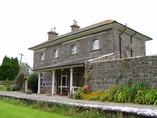
Detached four-bay two-storey railway station, built c. 1856, with open shelter to platform (west) supported on moulded timber posts. Modern glazed entrance porch to east elevation. Now in use as a private house. Hipped natural slate roof having overhanging eaves, and with two rendered chimneystacks having cut limestone capping and terracotta chimney pots. Lean-to roof to platform shelter. Render eaves cornice and string course. Snecked rusticated limestone walls over dressed limestone plinth with dressed limestone quoins to the corners. Segmental-headed window openings with moulded tooled limestone block-and-start surrounds (flush), cut stone sills and replacement windows. Segmental-headed opening to east elevation (behind porch) with cut limestone surround, and having glazed timber door with overlight. Segmental-headed opening to former platform (west) with cut limestone surround and replacement door. Station flanked to either side by sections of rubble stone walling. Square-headed doorway with wrought-iron flat bar gate built into wall to the north of main station building; squared-headed doorway with timber door built into wall to the south of main station building. Former railway platforms to either side of disused railway track (now removed) having cut limestone kerbing. Outbuilding to the south having rubble limestone walls and hipped natural slate roof. Former water tower (on square-plan) to the south, having snecked limestone walls and dressed limestone coping, original metal water tank now removed. Decorative wrought-iron railings to the east side of former water tower. Former goods shed (13401107) and railway signal box (13401106) to the south. Located to the northeast of Granard, close to the border with County Cavan.
This official record and map point do not grant access. Most recorded buildings are privately owned; view them only from public ground unless the owner allows entry.