Add your own picture and explain the route, parking, gates, paths or landmarks that help people find it.
Earn 5 points after the picture is checked and accepted.
Add your photo and local directionsShare what you foundWhat is recorded here
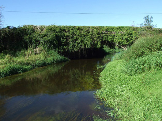
Single-arch road bridge over the Camlin River, built c. 1860. Constructed of coursed rock-faced limestone with rounded dressed limestone coping over parapet walls. Bridge largely overgrown with ivy. Terminating piers to either side of arch having splayed bases and with dressed coping over. Segmental-headed arch with rock-faced limestone voussoirs having dressed V-jointed dressed margins. Squared coursed dressed limestone to barrel and abutments. Skewed construction to barrel. Rubble stone wing walls to either end of bridge (north and south). Rock-faced string course to base of piers, possibly extending across bridge at road/deck level (overgrown). Located to the southwest of Ballinalee.
This official record and map point do not grant access. Most recorded buildings are privately owned; view them only from public ground unless the owner allows entry.