Add your own picture and explain the route, parking, gates, paths or landmarks that help people find it.
Earn 5 points after the picture is checked and accepted.
Add your photo and local directionsShare what you foundWhat is recorded here
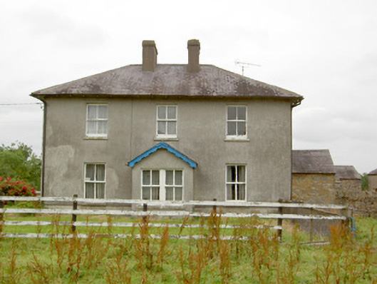
Detached three-bay two-storey house, built c. 1870, having gable-fronted porch to the centre of the front elevation (southeast) and a canted bay window to the southwest elevation at ground floor level. Possibly incorporating the fabric of an earlier building to site c. 1820 (Ordnance Survey map 1838). Single-bay single-storey outbuilding/extension attached to the northeast elevation. Hipped natural slate roof with overhanging bracketed eaves, cast-iron rainwater goods and a central pair of rendered chimneystacks. Roughcast rendered walls over smooth rendered plinth course. Square-headed window openings with two-over-two pane timber sliding sash windows and tooled limestone sills. Paired square-headed window opening to the southeast face of porch. Square-headed door openings with timber and glazed door to front porch and timber battened door to northeastern porch. Complex of single- and two-storey outbuildings arranged around a courtyard to the rear (northwest) having rendered and rubble stone walls, hipped and pitched slate and corrugated-metal roofs and square-headed openings. Entrance to rear yard through gateway to the southeast of complex having paired wrought-iron flat-bar gates and rendered gate piers. Set back road in own grounds to the southeast of Newtown-Forbes.
This official record and map point do not grant access. Most recorded buildings are privately owned; view them only from public ground unless the owner allows entry.