Add your own picture and explain the route, parking, gates, paths or landmarks that help people find it.
Earn 5 points after the picture is checked and accepted.
Add your photo and local directionsShare what you foundWhat is recorded here
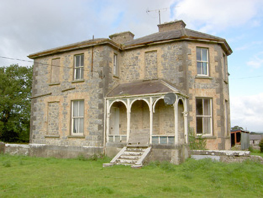
Detached three-bay two-storey over raised basement house on L-shaped plan, built c. 1845 and altered c. 1880, having full-height canted bay to the northeast elevation and veranda to the southeast elevation having round-headed timber arcading over dressed limestone plinth rail, accessed via flight of cut limestone steps. Hipped natural slate roofs with two redbrick chimneystacks. Roughcast lime render, now partially removed exposing squared limestone rubble masonry and brick reveals to the openings, and having dressed limestone block-and-start quoins to the corners. Chamfered dressed limestone plinth to ground floor to front elevation and at basement level to rear. Square-headed window openings with two-over-two pane timber sliding sash windows having tooled limestone sills and redbrick block-and-start surrounds, some windows now blocked. Six-over-six, three-over-three and four-over-four sash windows to the rear elevation (northwest). Square-headed door opening to the northwest face of veranda having six-panel timber door veranda. Timber battened door to rear elevation (northwest). Set in its own grounds to the southwest of Newtown-Forbes with complex of outbuildings (13400813) to the northwest. Main entrance gates to the northeast of house.
This official record and map point do not grant access. Most recorded buildings are privately owned; view them only from public ground unless the owner allows entry.