Add your own picture and explain the route, parking, gates, paths or landmarks that help people find it.
Earn 5 points after the picture is checked and accepted.
Add your photo and local directionsShare what you foundWhat is recorded here
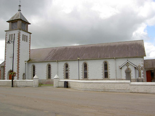
Freestanding Roman Catholic church, built c. 1956 - 61, comprising a seven-bay nave to the north, chancel to south and a three-stage tower (on square-plan) to the south end of the east elevation having a belfry with pyramidal slate roof over. Flat roof extensions to west and entrance porches to the north end of the nave and to the north end of the east side of nave. Pitched natural slate roof with cast-iron rainwater goods. Pitched slate roofs to porches. Pebbledashed walls over smooth rendered plinth with render quoins to the corners of the main building and to the attached tower. Sill course to nave. Snecked split concrete cladding to chancel. Round-headed window openings to east side of nave having stained glass windows and block-and-start render surrounds, semi-circular windows to west side of nave having stained glass and render surrounds, all with concrete sills. Full-height square-headed window openings to east and west sides of chancel with stained glass windows. Round-headed door opening east face of tower with render block-and-start surround and double leaf timber battened door. Segmental-headed doorway with timber battened door to the porch at the north end of the nave. Concrete portal roof frame to interior. Set back from road in own grounds to the north end of Ballinamuck. Pebbledashed boundary wall with rounded piers and paired wrought-iron gates to road-frontage (east). Graveyard to rear (west) with collection of grave markers c. 1858 to present day.
This official record and map point do not grant access. Most recorded buildings are privately owned; view them only from public ground unless the owner allows entry.