Add your own picture and explain the route, parking, gates, paths or landmarks that help people find it.
Earn 5 points after the picture is checked and accepted.
Add your photo and local directionsShare what you foundWhat is recorded here
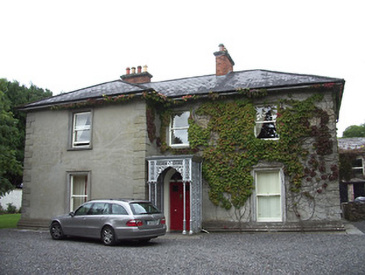
Detached three-bay two-storey house on L-shaped plan, built c. 1865, with projecting single-bay two-storey projection to the south end of the main façade (east) and with decorative cast-iron canopy to doorway. Various single and two-storey extensions and glazed conservatories to rear (west). Hipped and pitched slate roofs with overhanging eaves, two red brick chimneystacks and cast-iron rainwater goods. Unpainted rendered walls with moulded render plinth and with raised render quoins to the corners. Square-headed window openings with moulded render surrounds and having one-over-one timber sliding sash or timber casement windows. Central round-headed entrance opening with painted moulded surround, timber panelled door and with plain fanlight over. Elaborate cast-iron porch with Composite columns, barley sugar columns and fluted bases. Stone flagged paving to front elevation. Two-storey outbuilding/coach house to rear (west), having exposed roof timbers (covering removed), red brick chimneystack, and cast-iron rainwater goods. Coursed limestone construction with brick reveals to the openings. Square-headed window openings with stone sills, two-over-two timber sliding sash, and timber casement windows. Square-headed entrance openings with timber battened door and sliding timber battened door. Square-headed carriage arch to centre of main elevation (east). Timber door with bowed glazed panel to south elevation, accessed by wrought-iron spiral staircase. Set in landscaped surroundings, with cast-iron gateposts to driveway. Random rubble stone boundary walls to the east. Recessed gateway to the east having four rendered gate piers on square-plan with pyramidal capping over. Located to the north of Longford Town.
This official record and map point do not grant access. Most recorded buildings are privately owned; view them only from public ground unless the owner allows entry.