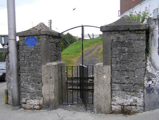
Add your own picture and explain the route, parking, gates, paths or landmarks that help people find it.
Earn 5 points after the picture is checked and accepted.
Add your photo and local directionsShare what you foundWhat is recorded here
Glacial Esker formed during the Ice Age and used as burial ground since c. 1650. The esker extends from near Timahoe to beyond Tullamore and was used as a road in medieval times. It contains several upstanding stone grave markers dating from c. 1700 to 1890 and is enclosed by coursed rubble stone wall c. 1800 with rough-hewn limestone coping and steel railing c. 2005, running along Ridge Road. The site is accessed by an iron turn-stile on a pair of large stone piers with cement capstones.
This official record and map point do not grant access. Most recorded buildings are privately owned; view them only from public ground unless the owner allows entry.