Add your own picture and explain the route, parking, gates, paths or landmarks that help people find it.
Earn 5 points after the picture is checked and accepted.
Add your photo and local directionsShare what you foundWhat is recorded here
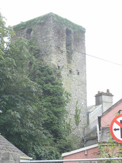
An early modern church ruin, built c. 1556. A three stage, west tower survives, built with a mixture of roughly coursed limestone and sandstone blocks with flat lintel doorway at ground floor level in the east wall, indicating that the tower was at the west end of the church. Flat-headed window on second floor east wall below belfry stage and tall round-headed windows in the upper stage facing in cardinal directions. Put-log holes to second stage. A tall recess at first floor level in the interior of the east wall may indicate an entrance to a gallery level at the west end of the church. Set within partially walled graveyard, south west of former Maryborough Fort.
This official record and map point do not grant access. Most recorded buildings are privately owned; view them only from public ground unless the owner allows entry.