Add your own picture and explain the route, parking, gates, paths or landmarks that help people find it.
Earn 5 points after the picture is checked and accepted.
Add your photo and local directionsShare what you foundWhat is recorded here
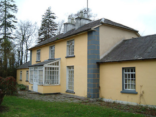
Detached three-bay two-storey house, c.1825, on a symmetrical T-shaped plan on a corner site with two-bay single-storey recessed flanking wings, and two-bay two-storey central return to west. Extensively renovated, c.1975, with single-bay single-storey lean-to projecting glazed porch added to centre ground floor. Hipped gabled slate roof on a T-shaped plan (hipped gabled roofs to wings; lean-to to porch) with clay ridge tiles, rendered chimney stacks, and iron rainwater goods on slightly overhanging rendered eaves. Painted rendered, ruled and lined walls with rendered quoined piers to ends. Square-headed window openings with cut-limestone sills, and replacement timber casement windows, c.1975, retaining six-over-six timber sash windows throughout (one two-over-two timber sash window to rear (west) elevation). Square-headed openings to porch with glazed timber panelled double doors having overlight, and fixed-pane flanking lights on panelled risers having casement overlights. Square-headed door opening to house with glazed timber panelled double doors having overlight. Set back from line of road in own grounds on a corner site with random rubble stone boundary wall to perimeter having rubble stone vertical coping, cut-stone piers having cut-stone capping, and iron gate.
This official record and map point do not grant access. Most recorded buildings are privately owned; view them only from public ground unless the owner allows entry.