Add your own picture and explain the route, parking, gates, paths or landmarks that help people find it.
Earn 5 points after the picture is checked and accepted.
Add your photo and local directionsShare what you foundWhat is recorded here
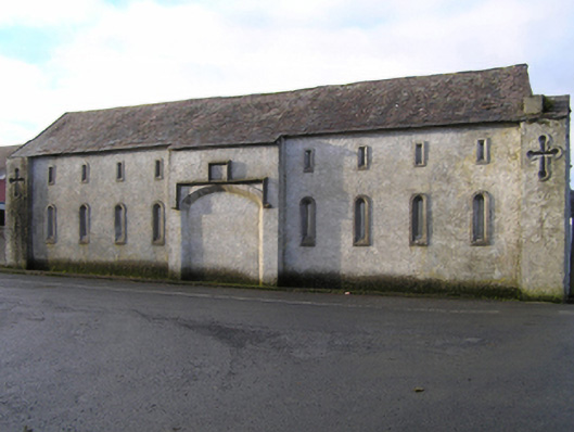
Detached nine-bay single-storey outbuilding with half-attic, dated 1839, on a shallow cruciform plan centred on single-bay full-height lean-to breakfront; five-bay full-height rear (west) elevation centred on single-bay full-height lean-to breakfront. Now disused. Pitched slate roof on a shallow cruciform plan extending into lean-to slate roofs (breakfronts), clay ridge tiles, rendered coping to gables, and no rainwater goods surviving on rendered cut-limestone eaves. Rendered walls with "Balistraria"-detailed rendered piers to corners. Tudor-headed central carriageway below drag edged dragged cut-limestone date stone ("1839"), drag edged dragged limestone ashlar voussoirs with hood moulding framing rendered infill. Round-headed flanking "loops" with square-headed "loops" (half-attic), dragged cut-limestone surrounds having chamfered reveals framing rendered infill. Segmental-headed central carriageway to rear (west) elevation with concealed dressings framing corrugated-iron double doors. Square-headed flanking window openings with drag edged dragged cut-limestone sills, and concealed dressings framing timber casement windows having square glazing bars (north) or louvered timber fittings (south). Road fronted on a corner site.
This official record and map point do not grant access. Most recorded buildings are privately owned; view them only from public ground unless the owner allows entry.