Add your own picture and explain the route, parking, gates, paths or landmarks that help people find it.
Earn 5 points after the picture is checked and accepted.
Add your photo and local directionsShare what you foundWhat is recorded here
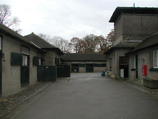
Farmyard complex, redeveloped 1915, possibly incorporating fabric of earlier ranges, pre-1840, on site including:(i) Detached seven-bay single-storey stable building on an L-shaped plan with single-bay single-storey breakfront, and three-bay single-storey wing perpendicular to right. Hipped roof on a L-shaped plan (hipped to breakfront) with clay tile laid in diagonal courses, clay ridge tiles, and iron rainwater goods on overhanging eaves. Unpainted roughcast walls. Square-headed door openings with tongue-and-groove timber panelled half-doors having overlights. Set back from road in grounds shared with Mount Juliet about a courtyard.(ii) Detached six-bay single-storey outbuilding with single-bay two-storey (stepped) advanced end bay to left. Hipped roofs with clay tile laid in diagonal courses, clay ridge tiles, roughcast chimney stack, and iron rainwater goods on overhanging eaves. Zinc-lined shallow pyramidal roof to end bay with iron rainwater goods on overhanging eaves. Unpainted roughcast walls with rendered stringcourse to first floor end bay. Square-headed window openings with concrete sills, and timber casement windows. Square-headed door openings with tongue-and-groove timber panelled doors (some having overlights; some tongue-and-groove timber panelled half-doors). Square-headed continuous window opening to first floor end bay with concrete sill, and fittings not discerned.
This official record and map point do not grant access. Most recorded buildings are privately owned; view them only from public ground unless the owner allows entry.