Add your own picture and explain the route, parking, gates, paths or landmarks that help people find it.
Earn 5 points after the picture is checked and accepted.
Add your photo and local directionsShare what you foundWhat is recorded here
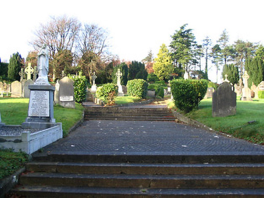
Graveyard with various cut-stone markers, post-1790-present.(ii) Remains of detached five-bay double-height Catholic church, built 1790, on a cruciform plan comprising three-bay double-height nave with single-bay double-height transepts to east and to west, and single-bay double-height chancel to south. Extended, 1813, probably with transepts completed. Demolished, post-1969. Unpainted rendered walls truncated, post-1969, to plinth level over random rubble stone construction with cut-limestone dressings including remains of rusticated doorcase.(iii) Freestanding belfry, pre-1903, comprising panelled tapered pedestal on a square plan with inscribed plaque, moulded capping supporting carved statuary, half-fluted pillars having decorative bas-relief detailing, cast-iron bell, and copper-clad swept pyramidal roof over having cross finial to apex.(iv) Gateway, pre-1840, to east on three cut-limestone steps comprising pair of unpainted rendered panelled piers with swept capping, wrought iron double gates having wrought iron lamp holder over, and unpainted rendered, ruled and lined flanking walls incorporating pair of round-headed pedestrian gateways with wrought iron gates having hood mouldings over.
This official record and map point do not grant access. Most recorded buildings are privately owned; view them only from public ground unless the owner allows entry.