Add your own picture and explain the route, parking, gates, paths or landmarks that help people find it.
Earn 5 points after the picture is checked and accepted.
Add your photo and local directionsShare what you foundWhat is recorded here
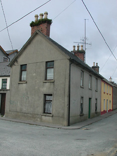
Attached three-bay two-storey house, c.1875, on a T-shaped plan on a corner site possibly incorporating fabric of earlier house, pre-1840, on site with two-bay two-storey side (south) elevation, and single-bay two-storey central lower return to west. Part refenestrated, c.1975. One of a pair. Pitched (shared) slate roof (pitched to return) with clay ridge tiles, red brick Running bond chimney stacks having grouped (three) yellow terracotta octagonal pots, and replacement plastic rainwater goods, c.1975, on rendered eaves having iron brackets. Unpainted rendered walls with rendered strips to ends, rendered band to eaves, and unpainted rendered, ruled and lined walls to return having rendered quoins. Square-headed window openings with cut-stone sills, rendered surrounds, and one-over-one timber sash windows to front (east) elevation (wrought iron sill guards to ground floor) having replacement timber casement windows, c.1975, to remainder. Square-headed door opening with rendered surround, and glazed timber panelled door. Road fronted on a corner site with concrete footpath to front.
This official record and map point do not grant access. Most recorded buildings are privately owned; view them only from public ground unless the owner allows entry.