Add your own picture and explain the route, parking, gates, paths or landmarks that help people find it.
Earn 5 points after the picture is checked and accepted.
Add your photo and local directionsShare what you foundWhat is recorded here
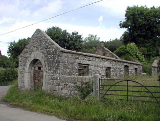
Detached single-bay (three-bay deep) single-storey gable-fronted forge, extant 1901, on a rectangular plan. Now in ruins. Pitched (gable-fronted) roof now missing with abbreviated red brick Running bond chimney stack, and no rainwater goods surviving on red brick header bond eaves. Coursed or snecked rubble granite walls with benchmark-inscribed cut-granite flush quoins to corners. Horseshoe-shaped carriageway with "nail hole"-detailed cut-granite surround. Square-headed window openings (side elevations) with cut-granite sills, and cut-granite lintels with no fittings surviving. Interior in ruins. Road fronted on a corner site with cut-granite monolithic piers to perimeter having shallow pyramidal capping supporting flat iron "farm gate".
This official record and map point do not grant access. Most recorded buildings are privately owned; view them only from public ground unless the owner allows entry.