Add your own picture and explain the route, parking, gates, paths or landmarks that help people find it.
Earn 5 points after the picture is checked and accepted.
Add your photo and local directionsShare what you foundWhat is recorded here
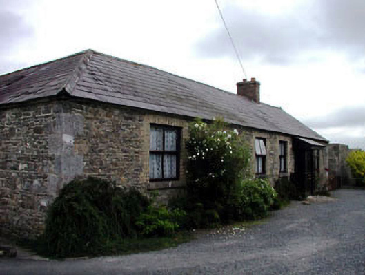
Detached five-bay single-storey double-pile rubble stone house with attic, c.1850, on an L-shaped plan with three-bay single-storey return to rear to north-east having segmental-headed integral carriageway opening into internal courtyard. Renovated and refenestrated, c.1980, with two-bay single-storey infill block added to rear elevation to north-east and single-bay single-storey advanced glazed porch added to entrance. Gable-ended roof on an L-shaped plan with slate (replacement artificial slate, c.1980, to double-pile section). Clay ridge tiles. Red brick chimney stacks. Square rooflights. Yellow brick course to eaves. Rainwater goods now gone. Flat-roof to infill block. Corrugated-iron. Rubble stone walls. Hammer dressed stone ashlar quoins to corners. Square-headed window openings. Stone sills. Yellow brick dressings. Timber lintel to opening to return. Replacement timber casement windows, c.1980. Glazed timber advanced porch, c.1980, to entrance. Square-headed door opening. Timber panelled door. Segmental-headed integral carriageway. Hammer dressed stone ashlar surround. Yellow brick dressings. Replacement timber panelled double doors, c.1980. Set back from road in own grounds.Formal avenue to north-west with cut-granite monolithic stones to boundary.Gateway, c.1850, to north-west comprising pair of cut-granite piers with cast-iron gates.
This official record and map point do not grant access. Most recorded buildings are privately owned; view them only from public ground unless the owner allows entry.