Add your own picture and explain the route, parking, gates, paths or landmarks that help people find it.
Earn 5 points after the picture is checked and accepted.
Add your photo and local directionsShare what you foundWhat is recorded here
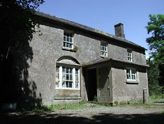
Detached three-bay two-storey farmhouse, extant 1837, on a T-shaped plan originally three-bay two-storey on a rectangular plan centred on single-bay single-storey projecting porch to ground floor. Occupied, 1911. Now disused. Pitched slate roof with lichen-covered ridge tiles, cut-granite coping to gables with red brick Running bond chimney stacks to apexes on red brick Running bond bases having stringcourses below capping, and cast-iron rainwater goods on rendered cut-granite eaves retaining cast-iron hoppers and downpipes; hipped slate roof (porch), clay ridge tiles, and cast-iron rainwater goods on exposed timber rafters retaining cast-iron downpipe. Roughcast battered walls with concealed flush quoins to corners; roughcast surface finish (porch) on rendered plinth with rendered block-and-start piers to corners. Square-headed window opening (porch) with cut-granite sill, and block-and-start surround framing timber casement window. Square-headed window openings in tripartite arrangement with cut-granite sills, timber mullions, and concealed dressings including cut-granite lintels framing six-over-six timber sash windows having two-over-two sidelights. Square-headed window openings (first floor) with cut-granite sills, and concealed dressings framing six-over-three timber sash windows. Set in unkempt grounds with rusticated granite ashlar piers to perimeter having stringcourses below ball finial-topped capping supporting wrought iron double flat iron "farm gate".
This official record and map point do not grant access. Most recorded buildings are privately owned; view them only from public ground unless the owner allows entry.