Add your own picture and explain the route, parking, gates, paths or landmarks that help people find it.
Earn 5 points after the picture is checked and accepted.
Add your photo and local directionsShare what you foundWhat is recorded here
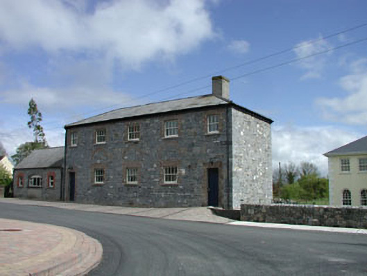
Detached five-bay two-storey rubble stone former school, c.1835, with three-bay single-storey wing to left (north-east) originally having shallow segmental-headed integral carriageway. Renovated, c.1995. Now in use as community centre. Hipped roof with slate (gable-ended to wing). Clay ridge tiles. Rendered chimney stack. Cast-iron rainwater goods on eaves course. Broken coursed square rubble stone walls. Red brick relieving arches over openings to ground floor. Square-headed window openings. Stone sills. Red brick block-and-start surrounds. 4/4 timber sash windows (possibly replacement, c.1995). 1/1 timber sash windows to wings. Square-headed door openings. Red brick block-and-start surrounds. Timber panelled doors. Shallow segmental-headed integral carriageway to wing remodelled, c.1995, with timber casement window inserted. Road fronted. Concrete brick cobbled footpath to front.
This official record and map point do not grant access. Most recorded buildings are privately owned; view them only from public ground unless the owner allows entry.