Add your own picture and explain the route, parking, gates, paths or landmarks that help people find it.
Earn 5 points after the picture is checked and accepted.
Add your photo and local directionsShare what you foundWhat is recorded here
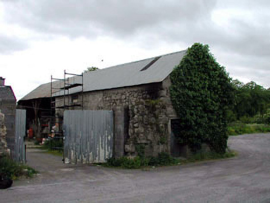
Detached three-bay double-height rubble stone outbuilding, c.1850, with single-bay double-height open bay to left. Reroofed and partly reconstructed, c.1980. Gable-ended roof. Replacement corrugated-iron, c.1980. Iron ridge tiles. Rainwater goods now gone. Random rubble granite walls. Sections of exposed concrete block, c.1980, to front (south-east) elevation. Square-headed open bay to left with timber supports. No fittings. Square-headed door opening to side (north-east) elevation. Cut-stone lintel. Timber boarded door. Square-headed (slit-style) window openings to rear (north-west) elevation. Red brick dressings. No fittings. Set back from road in grounds shared with house (11823005/KD-40-23-05).
This official record and map point do not grant access. Most recorded buildings are privately owned; view them only from public ground unless the owner allows entry.